Saturday, June 1, 2019

Departing for Iceland

Sorvagur, Faroe Islands

Current Conditions: 90% overcast, with intermittent showers. Not hot. Wind 12-15 kn. easterly

We sailed to Sorvagur yesterday with thoughts of basing here for a few days to hile and spend a day in Mykines. But...


Weather is expected to deteriorate over the next 48 hours as a low will be strengthening and moving east just south of the Faroe Islands. Thus, we have made the difficult choice to leave Faroe today ahead of the change. We will be seeing (we think!) 15-20 kn. east, backing to NE. At least less time here will equate to more time in Iceland.

So we are bound for Seydisfjordur, Iceland imminently. Good bye, Faroes!

Cruisers nugget: There does not appear to be a reasonable place to tie up here. The wharf in front of the old fish plant is occupied by local baots or ferry leaving only the outer wall with tire issues as noted in the guides and one must beware of getting caught below the tires. We had a tire watch with timely adjustments. Not recommended in 2019.

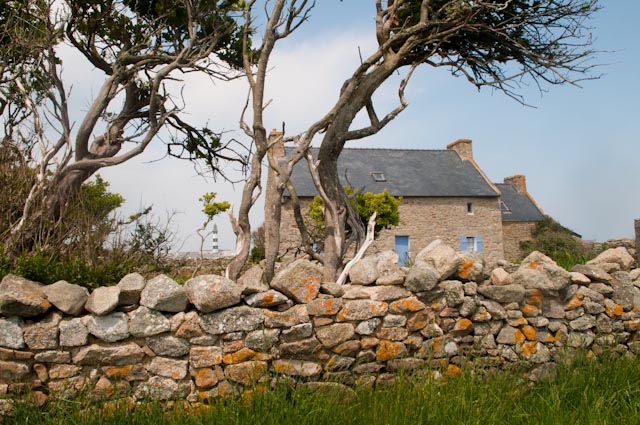
Pictures of Sorvagur...


You will next here from us in Iceland.

Best, Bill and crew of Visions of Johanna

Thursday, May 30, 2019

Faroe Islands

The sail from Skye to Faroe was generally as predicted. Light winds from the SE at the outset found us motoring north, wind building gently forward then backing aft towards the beam 1/2 way through up to 15 kn. Check, check, and check resulted in some decent sailing during that middle portion.Finally, the wind was to swing forward by the end of our sail. Which it did, but at 20-25 knots, not 15...so let's say that the last 1/3 of the trip was a bit lumpy except when we closed on the south tip of the island of Suduroy (pronounced SUU-roy as the "d" is silent when spelled with a slash through it) where upon seas became quite animated. We arrived in Tvorori around 6:30 PM and were happy to be in harbor.


The harbourmaster's name is Christian and Christian was a wonderful help with paperwork, locating customs and immigration, etc. He might often be too busy to reply to an entry call on CH. 16 but after several unsuccessful attempts, Torshaven radio came back to us and instructed us that they would contact the HM to inform him of our impending arrival; he did later respond to our call. As for berthing, a major mid-town wharf previously used for tie up has been occupied by a new fish processing plant (2013) and best option now seems to be to lie at a down-harbor wooden wharf but the wharf had the primo inner spot occupied by a local boat and the hammerhead occupied by one of the two cruising boats we came upon. We initially attempted to tie to the side-to face of the wharf but ultimately elected to anchor out for the night. The next morning the wharf was free and we went alongside.


Still, it was a very protected anchorage, all was good and we settled in. Monday and Tuesday were filled with some sightseeing about town and cruising necessities such as gathering access tools for navigation and Internet phone access. We found wifi at the Information Sight office but mobile data was difficult to impossible to realize as the Vodafone system would connect to some of our phones but would never connect to the Internet. I spent hours on the phone with Voda, and visited a local phone ISP. No solutions, still a problem. I plan to give in and buy a Faroese plan for these islands on Foraya Tele.


Doug and Chuck did quite a bit of exploring about Tvorori. We were one of the early boats to arrive and were interviewed by local officials for the island website and the mayor came to greet us. We enjoyed an awesome hike on Tuesday to a lake on the east coast of the island, scenery fantastic and superb photo ops.


Cruiser's nugget: EU roaming and cellular data by Vodafone may or may not be available. It was not available for us. The commercial chandlery down by the fish plant is owned by Jens Sigurd Simonsen. Jens was happy to assist us and was a great help providing information about needed gear/items


Itineraries finally discussed, we looked at moving north to Torshaven (TOR-shven). Although only 35 nm., weather and currents make passage planning an interesting proposition. I deduced that best compromise was to depart Tvorori at 1 1/2 hours after high water Dover and although windy on Wednesday, the wind was NWly. Thursday was only a modest amount lighter but NNW winds were forecast so we left Wednesday morning in 20-25 knots NW. I had triple reefed main and staysail out as we departed and we were moving along respectably but once we hit ocean swells and wind waves we needed a bit more punch and the yankee jib was partially unfurled. This 3 sail grouping was fantastic and we had an exhilarating sail, initially beam then close reaching making 8-9 knots with ability to roll in the jib and de-power when squalls came through. Said squalls were frequent and blowing 28-34 knots, but they were brief and the sky was blue between - we have been quite fortunate to avoid days on end of thick low clouds, we have had blue sky visible somewhere most of the time, sharing the sky with banded fast moving squalls.


Cruiser's nugget: We decided that the decision to depart Tvorori for Torshaven 1 1/2 hours after high water Dover was a good one. We conservatively stayed 4 nm. off islands and passes, but slid west to 2 miles off as we gained confidence in reasonable sea conditions. Wind was 20-30 kn. NW, current arrows were mildly adverse swing to abeam and aft but no major rips encountered.

We closed in on Torshaven close hauled with snow capped tops visible on the mountains. Our one tack, made to gain ground to the west brought us into another squall, this time accompanied by a face stinging hail storm. I described the passage as fantastic sail, beautiful sights, quite windy with a side of hail. All good!

Please visit this blog site where PHOTOS will be posted.


Best wishes from Bill and the crew of Visions of Johanna.

----
This e-mail was delivered via satellite phone using GMN's XGate software.
Please be kind and keep your replies short.

Saturday, May 25, 2019

Bound for Faroes

DATE: Saturday, 25 May 2019 0800 GMT+1
SY Visions of Johanna Hebrides to Faroes Crossing Day 1, post #1
Sea: The Little Minch
Position: 57 29.8N/6 46.48W (23 nm south of Stornoway)
SOG 7.2 knots; COG 017 mag
TWS 10.2 kn ; TWD: 253 mag

Current situation: Motoring, light winds, 100% low clouds, intermittent showers. Not hot.

Good day all, and ahoy from S/Y Visons of Johanna and her crew of Doug, Chuck and yours truly. Doug and Chuck arrived Thursday night which was a day later than planned and much anticipated. Jack left us Friday morning and soon thereafter we pushed off from the port of Mallaig, headed for the west coast of the Isle of Skye. Here are a few of the sights along the way from Northern Ireland.


Above is the famous lighthouse at Point Ardnamurchan, the point of land that separates the more routine sailing in the southern Hebrides from the more adventuresome north. Fable has it that you tie a bouquet of heather to your bow as demonstration of passage.

We departed from the fishing port of Mallaig, harbour entry seen below. As fishing has declined, Mallaig has stepped up to become a bit of a tourist destination, aided by ferry service to the islands and rail links inland via some of the most picturesque train rides imaginable.


Our initial plan was to sail from Skye to Stornoway on the the Isle of Lewis in the Outer Hebrides and leave for the Faroes from Stornoway in a day or two, but...after perusing the weather it became apparent that the next 36 hours provided the best weather window and the desirability of the weather for crossing diminished by the day. The plan was also to make for Loch Dunvegan on Skye's west coast but a late start from Mallaig prompted us to stop late afternoon into Loch Bracadale on the SW corner. Decision was to get more weather info and get going early Saturday morning while we confirmed and updated weather data. So, after a fantastic dinner of sauteed crayfish with pesto sauce, green salad, and steak and baked potatoes, we turned in early for a well earned a sleep. Then, up we were at 0430 this morning to weigh anchor at 0500 and underway.

Below is the Isle of Skye from the south...on a sunny day on approach to Mallaig.


Current weather files continue to suggest that we forgo our planned stop at Stornaway so off we are, bound for Tvoroyri on the Island of Suduroy - the southern most Island of the 18 island Faroe group. With it's Norse heritage, Faroes are mostly autonomous but perhaps can be termed a "protectorate" of Denmark. Fantastic scenery and wildlife with some of the most dense bird nesting colonies in the world await us.

We are warm and comfortable aboard. Great spirits and not one threat of mutiny is detected. So far.

Update at 0915. Just pulled down UK Met high seas extended outlook that now confirms high winds forecast in the Tues/Wed time frame in the Faroes and Hebrides respectively, so we are pleased and content with our decision to push on.

We will keep you posted.

Warmly,

Bill and the crew of Visions of Johanna


----
This e-mail was delivered via satellite phone using GMN's XGate software.
Please be kind and keep your replies short.

Tuesday, May 29, 2018

Arrival in Castletownshend, Ireland, County Cork

Anchor down at 0900 this morning after a serene overnight passage. We had the calmest of seas and sufficient wind to sail more than 2/3 of the time, quietly hissing through calm ocean waters with a full moon and a gentle 5-8 degree heel. Castletownshend was a good choice for landfall, easy entry, very enclosed and wonderfully protected. A former fishing town, it is now a holiday village - a very small village with a tiny store and two pubs, one with a renowned restaurant that we have reservations at tonight. There are also several hotels and B&B's galore. After arrival we had a nice 6 mile coast walk and will spend another day here (we think) before going all of six nautical miles to the not quite as small village of Glandore,

More soon, Bill and Johanna


----
This e-mail was delivered via satellite phone using GMN's XGate software.
Please be kind and keep your replies short.

Monday, May 28, 2018

Bound for Republic of Ireland

Decision is to leave today for Ireland. There is at least one more island to visit/experience here...Bryher is supposed to be quite pretty and laconic...but it is a cloudy day and Castletownshend beckons. No significant weather concerns either way as winds are very light today and only a bit better tomorrow.

Plan is to up anchor in less than an hour bound for Castle Haven Harbour, town of Castletownshend, County Cork, Ireland.Track us on Garmin mapshare: https://share.garmin.com/. Password is SVJOJO.

A 22 hour passage is expected and we will be in touch from the other side of the Celtic Sea.

Bill and Johanna

----
This e-mail was delivered via satellite phone using GMN's XGate software.
Please be kind and keep your replies short.
Hello from the Isles of Scilly. We had a great passage from Ilse D'Ouessant to St. Mary's, Scilly Isles. We motored for two hours against a light headwind and then as predicted, winds clocked and built to a nice moderate NE to easterly and we had five or six great hours of sailing averaging 9 knots for two of the hours before the wind died. We motored the last 3 hours or so making water, charging batteries, etc. Nice sailing, fine weather.

Our landfall was the south facing harbour of Porth Cressa, 13 hours sailing port to port. Unfortunately, even though swells offshore were not large, a major roll was coming into Porth Cressa and the 8 boats anchored there had masts swinging like asymmetric metronomes. It did not look comfortable and as two boats were electing to weigh anchor and leave we also chose to go around to St. Mary's Pool on the north side where we anchored for the night.

St. Mary's harbour is busy with ferry's, passenger inter-island boats, fishing boats - all zooming by. The harbour-master gave a knock the next morning and offered us a mooring which we gratefully accepted as we were at their size limit. Our stern was also apparently edging to the channel so they were happy too.

We spent 2 1/2 days exploring St. Mary's. Great coastal walks around the island with bird song and wild flowers everywhere. And some history. The Cornish coast but especially Isles of Scilly are a traditional home of rowing gigs. Scilly is the seat of gig rowing and racing as traditionally gigs were used for island transport, ship rescue, and of course, bringing contraband from Brittany. There is racing here several times per week and the Rowing Gig world championships were recently held here. A Belfast (Maine) rowing team participated this year and our first day on the island included lunch out at Juliettes Farm, a restaurant recommended by a rower from the women's team We then did a long walk 3/4 of the way around St. Mary's, hiking past ancient village sites and burial resting places that dated back 6000 years to the Bronze age. We walked past Port Hellick where one of the greatest British naval disasters ever occurred; a captain of a British naval fleet ca. 1640 was sailing by and stopped to record "soundings". Much of the fleet was lost on the "western rocks" of Port Hellick and 1670 sailors perished. Times were different then...

More walking and exploring on our second day. We invited the local OCC Port Officer to join us for wine and appetizers and had a nice evening with him. He came aboard the next day (Saturday) for the short sail to Tresco, where we are right now.

I have posted some pictures from Ile D'Ouessant on our blog site: vofj.blogspot.com. Take a look! We will likely depart later today for the Republic of Ireland and will keep you posted.

Smooth sailing,

Bill and Johanna
----
This e-mail was delivered via satellite phone using GMN's XGate software.
Please be kind and keep your replies short.

Tuesday, May 22, 2018

From Visions of Johanna

Hello to all. A fine day today on Ile d'Ouessant. Croissants at the boulangerie began the day followed by a walk and Crepes for lunch (Johanna ticked two more Brittany items off her list). Good thing as this was her last chance!! We then hiked for the afternoon. Tres jolie. Hopefully some pictures will follow. (Edit: see below!)

Which reminds me of a few things...

You can go to our blog at vofj.blogspot.com to read our mails but also hopefully to see photos (soon). We need good wifi to upload.
You can follow our travels at the Garmin mapshare sight: https://share.garmin.com/. Password is SVJOJO.

And a small editorial comment. There was an error yesterday in the spelling of the island name Ile D'Ouessant which is corrected in today's mail. See, this is not fake news.

And another small editorial comment. I despise the term fake news and pledge never to use it again!!


We will be up early tomorrow to raise anchor at 0600 hours with a 12-14 hour day planned to cross to St. Mary's in the Isles of Scilly (pronounced "Silly"). Go to our mapshare sight to follow along!


Great to be in touch with all you special people.

Warmly, Bill and Johanna


----
This e-mail was delivered via satellite phone using GMN's XGate software.
Please be kind and keep your replies short.